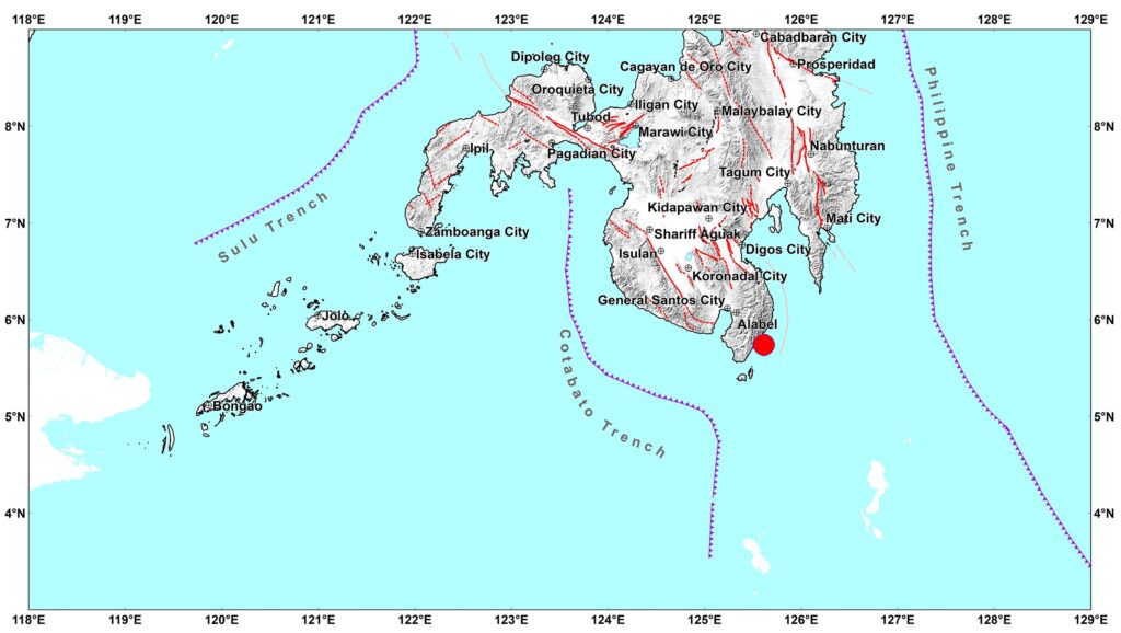
The Mindanao earthquake that struck offshore near Sarangani early Monday morning, June 8, left rescue teams checking collapsed structures, damaged roads, and public buildings across parts of southern Philippines. Officials were still counting casualties on Tuesday, June 9, with aftershocks keeping many residents outside damaged homes.
Damage in Sarangani and General Santos
The magnitude 7.8 quake struck near Maasim, Sarangani, early Monday morning, and was felt strongly in General Santos City and nearby areas. Reports from the ground described collapsed commercial structures, damaged government buildings, power interruptions, and schools placed under inspection before classes could safely resume.
Sarangani also reported landslides after the shaking. In General Santos, local authorities declared a state of calamity as rescue teams, engineers, police, health workers, and relief personnel moved through affected sites. Some hospitals treated patients in tents or temporary areas while their own buildings were checked for cracks and structural risk.
At least 37 people were reported dead, with hundreds injured and several still missing, based on Tuesday reports. Search and clearing work continued, so the figures may still change.
Aftershocks and the Next Few Weeks
PHIVOLCS recorded several aftershocks after the main quake, including a strong one reported at magnitude 6.7. That is why officials keep warning people not to return quickly to damaged structures.
Aftershocks usually become fewer over time, but they can still be strong enough to shake already weakened buildings. Residents should watch for cracked walls, leaning posts, damaged stairs, broken glass, and movement on slopes near houses or roads.
Coastal communities should also keep following tsunami advisories. The warning issued after the quake was later lifted, but small tsunami waves were observed in some areas. For families near the shore, the safer habit is to move inland or uphill when an official warning comes, then wait for the all-clear.
Why Earthquakes Are Common in the Philippines
The Philippines sits along the Pacific Ring of Fire. This means the country lies near the edges of moving tectonic plates, where earthquakes and volcanic activity are common.
Mindanao is close to active trenches and fault systems. When movement happens offshore, the shaking can damage buildings on land. If the seafloor moves in a certain way, it can also create tsunami waves. Not every offshore quake does this, which is why PHIVOLCS advisories matter after strong undersea earthquakes.
The country records many earthquakes every year. Most are weak and pass without damage. The dangerous ones are the quakes that hit near cities, coastal towns, mountain slopes, or older buildings.
Quakes and Tsunamis Filipinos Remember
The 1976 Moro Gulf earthquake and tsunami killed thousands in Mindanao and remains one of the deadliest disasters in Philippine history. The 1990 Luzon earthquake killed more than 1,600 people and caused heavy damage in Baguio, Cabanatuan, and other areas.
More recent events include the 2019 Cotabato earthquakes, the 2022 Abra quake, and the 2025 Cebu quake. Each one exposed the same weak points: unsafe buildings, blocked roads, damaged schools, and families unsure where to go after the shaking.
The Mindanao earthquake now adds another case for stricter building checks, clearer evacuation routes, and regular drills in schools, malls, hospitals, and coastal barangays.